Protect your property from flooding and wave erosion, safeguard drinking water, and protect natural areas for future generations
Experiencing a localized flooding emergency?Contact your local fire detachment or Emergency Operations Centre.
Flooding is a common and naturally occurring event in British Columbia. Waterfront landowners are entitled to protect their upland property from flood damage through construction of flood protection works above riparian areas, such as the use of sandbags to protect property during a flooding emergency.✱
However, the Water Sustainability Act does not allow waterfront property owners to construct flood protection or other works in and about a stream (usually within 30m of the average High Water Mark) during a flooding emergency (e.g. culverts, drainage diversions). Get Flood Ready!
Waterfront landowners must apply for a Change Approval or submit a Notification of instream works for ALL changes in and about a stream, including post-flooding recovery works.
- Flood Information for Homeowners and Home Buyers: Advice for Protecting your Home and Property [PDF] Note: document includes instructions on how to build a sandbag dike
- Flood Recovery Information for Waterfront Landowners [PDF]
- Information Bulletin: How to Replace your Dock
- Information Bulletin: Reminder to Waterfront Landowners about Land Status
Know Your Lakeshore
A Healthy And Natural Shoreline
keeps the water safe and clean for people and animals
- The Shoreline
- The area where water meets the land at its highest natural boundary. It is also known as the foreshore or lakeshore.
- The Foreshore
- The area below the natural boundary that allows for the rise and fall of lake levels during seasonal flooding from low to high water marks.
These areas provide habitat to some of the most biologically diverse and unique aquatic and terrestrial species and their preservation is essential to a healthy functioning ecosystem and watershed.
Plants Along the Shoreline
can protect property damage from flooding, high waters and waves
Roots of trees and shrubs form a network of roots that form a rebar-like reinforcement through the soil, adding strength to the shoreline and reducing erosion.
Plants also act like a water pump, moving large amounts of water from the soil into the air.
- Lakeshore Stabilization [PDF]
- Streambank and Shoreline Protection Manual [PDF]
- Lake Shoreline Stabilization Techniques [PDF]
- Live Staking and Joint Planting [PDF]
- Engineering With Nature Alternative Techniques to Riprap Bank Stabilization [PDF]
- Stability Thresholds for Stream Restoration Materials [PDF]
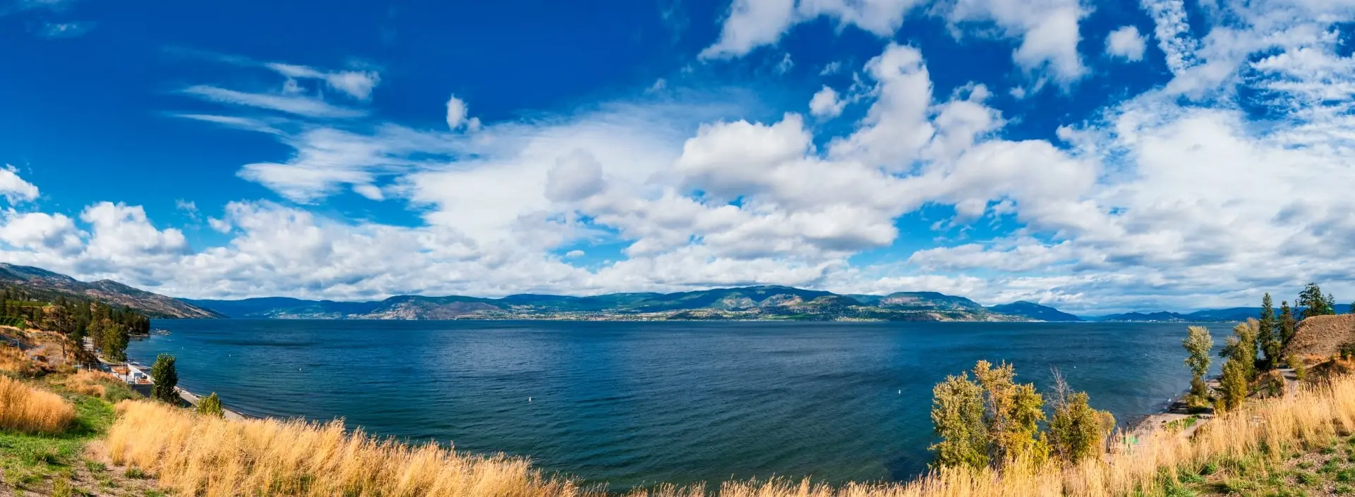
Okanagan Lake Has 290 km Of Shoreline
and research from the 2016 Foreshore Inventory and Mapping update shows that the majority is developed, with only 41% remaining natural
In 2016, as part of a 7-year study, the entire 290 km shoreline of Okanagan Lake was mapped and analyzed using science-based research methods. Foreshore Inventory and Mapping (FIM) is a standardized method of collecting information on the current state of the foreshore, or shoreline, of a lake.
Foreshore Inventory and Mapping provides an updated summary of the condition of the Okanagan Lake shoreline in 2016, and allows researchers to compare the current landscape with earlier conditions. This provides an ongoing measure of the environmental impacts that accumulate from lakeshore development over time.
Increased Shoreline Development
from 2009 to 2016, has added 165 retaining walls, 164 docks, and 9 new marinas around the lake
As population in the region continues to grow, there is increased development around Okanagan Lake and every change to the landscape has a direct effect on the ability of the lake to support us. If the current rate of loss is maintained, the entire lakeshore will be developed within the next 1-2 generations. Key actions and recommendations to help reverse this trend are identified in the FIM report.
Okanagan Lake and its connecting waterways are important resources which provides drinking water, water for our crops, recreation and tourism, and supports aquatic and terrestrial ecosystems that are vital to a sustainable and healthy environment.
The Okanagan Valley is Biologically Unique
with some of the greatest concentrations of species and ecosystems in Canada. Many are found nowhere else in the country and in some cases the world.
The Okanagan is known for its natural beauty and unique landscapes, and is one of the most biologically diverse areas in British Columbia and across Canada. Low elevation grasslands, wetlands, and riparian areas are threatened by increased urban and agricultural development and demand for access to the lakeshore.
Okanagan Valley is a major international migratory bird corridor for waterfowl, such as the Western Grebe and American Avocet. Migratory Birds help control insects, and are important for transporting nutrients across the landscape. We have lost much of their historical habitat to development in the Okanagan Valley, and many species are at risk of extinction. You can help them by protecting and enhancing the Okanagan Lake shoreline.
Loss of natural areas places our current lifestyle and well-being at risk. However, if everyone helps to expand natural areas in their neighbourhoods, we can help support local species and restore habitat.
Okanagan Lake Has Two Distinct Types Of Kokanee Salmon
that rely on sediment-free streambeds and lakeshores for spawning habitat.
- Sockeye Salmon travel to the ocean and back
- Kokanee Salmon [PDF] remain in fresh water for their entire life
- shore-spawners lay eggs along the edge of a lake
- stream-spawners [PDF] swim upstream to lay eggs and are the larger of the two
Kokanee populations in Okanagan Lake are in severe decline due to decreasing lake productivity, degraded stream habitat, and competition for food with an introduced freshwater mysis shrimp.
Climate researchers warn that the changing temperature and precipitation patterns forecasted for the Okanagan could have a large impact our local salmon populations, through lower water levels in streams and rivers, higher water temperatures, and more intense flood events that can scour eggs from the spawning beds.
The Syilx/Okanagan First Nation Territory
extends from North of Revelstoke into Washington state. Learn more about the syilx/Okanagan Nation and read about their Water Declaration here: www.syilx.org/about-us/syilx-nation/water-declaration/
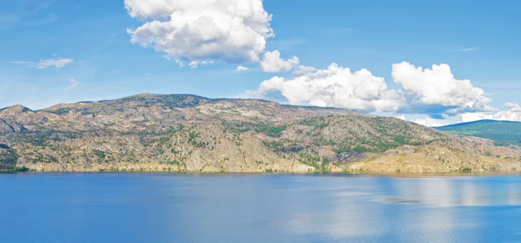
Keeping the Lakeshore Natural is Important
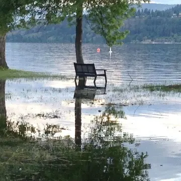
Protect Your Property From Flooding
Deep-rooted trees and shrubs absorb water and wave energy, reducing shoreline erosion. This helps protect your property from flooding.
Naturally vegetated lakeshores provide erosion control through deep plant roots that hold soils together and have the ability to uptake water and bring it back to the atmosphere through evapotranspiration.
When the natural lakeshore is altered by land clearing, soil disruption, or the removal of native vegetation, important flooding and erosion measures are lost—sometimes permanently.
Artificial retaining walls break down overtime and are expensive to maintain in the long run. They also increase disturbance to the foreshore area, and create a barrier to ecosystem connectivity.
Safeguard Your Drinking Water
Native plants, trees, rocks, and soil help filter rain and stormwater runoff by trapping sediment and contaminants which protects water quality.
- reducing sediment run-off during storms
- filtering groundwater water and trapping bacteria with their roots, removing nutrients and sequestering metals in their fibres
- filtering water as it is returned back to the atmosphere through the leaves
- increasing the water infiltration into groundwater aquifers
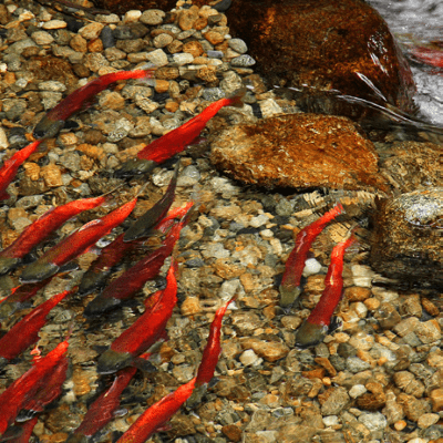
Care For Kokanee And Wildlife
Fish spawn along the shoreline, and eagles and osprey rely on them for food. All wildlife need a healthy and safe place to survive and thrive.
Development near lakes, streams, and rivers not only increases movement of sediment into the water, which covers Kokanee spawning beds, it also blocks access to water for wildlife, and creates a barrier to travel between habitat patches.
Species like badgers, deer, owls, spadefoot, painted turtles, bats and shore-spawning kokanee fry rely on connecting corridors for survival, and to access Okanagan Lake for fresh water, food sources, and habitat.
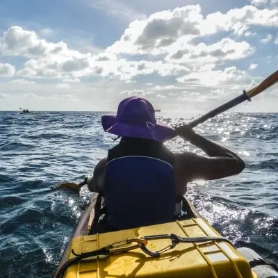
Champion Lakeshore Living
A healthy lake allows everyone to enjoy recreational activities on and around the lake. Help sustain the lake for your community, your health, and your well being. Become a guardian of the lake by protecting and enhancing the shoreline for visitors, residents, and future generations.
Waterfront property owners have the added responsibility of caring for the lakeshore and its surrounding areas. A balance is necessary between protecting your investments and protecting the environment.
Lakeshore plants, woody debris, and falling leaf litter provide food and shelter for animals and habitat for fish. Terrestrial upland areas also form part of your buffer zone, attracting birds and wildlife for viewing and promoting connectivity.
Empower Economic Growth And Tourism
People from around the world come to work and play on Okanagan Lake. Keeping our shorelines natural can enhance property value, and protect the Okanagan’s beautiful vistas for everyone’s enjoyment and benefit.
Studies show that naturally vegetated lakeshore properties can increase property value.
- The Value of Natural Capital in Settled Areas of Canada [PDF]
- Impact of Natural Features on Property Values [PDF]
- Got Land? Six Ways to Value the Economic Benefits of Parks & Open Space (note: Internet Archive link)
- The impact of parks on property values: empirical evidence from the past two decades in the United States
- Green Shores ™ for Coastal Development Credits and Ratings guide for waterfront properties [PDF]
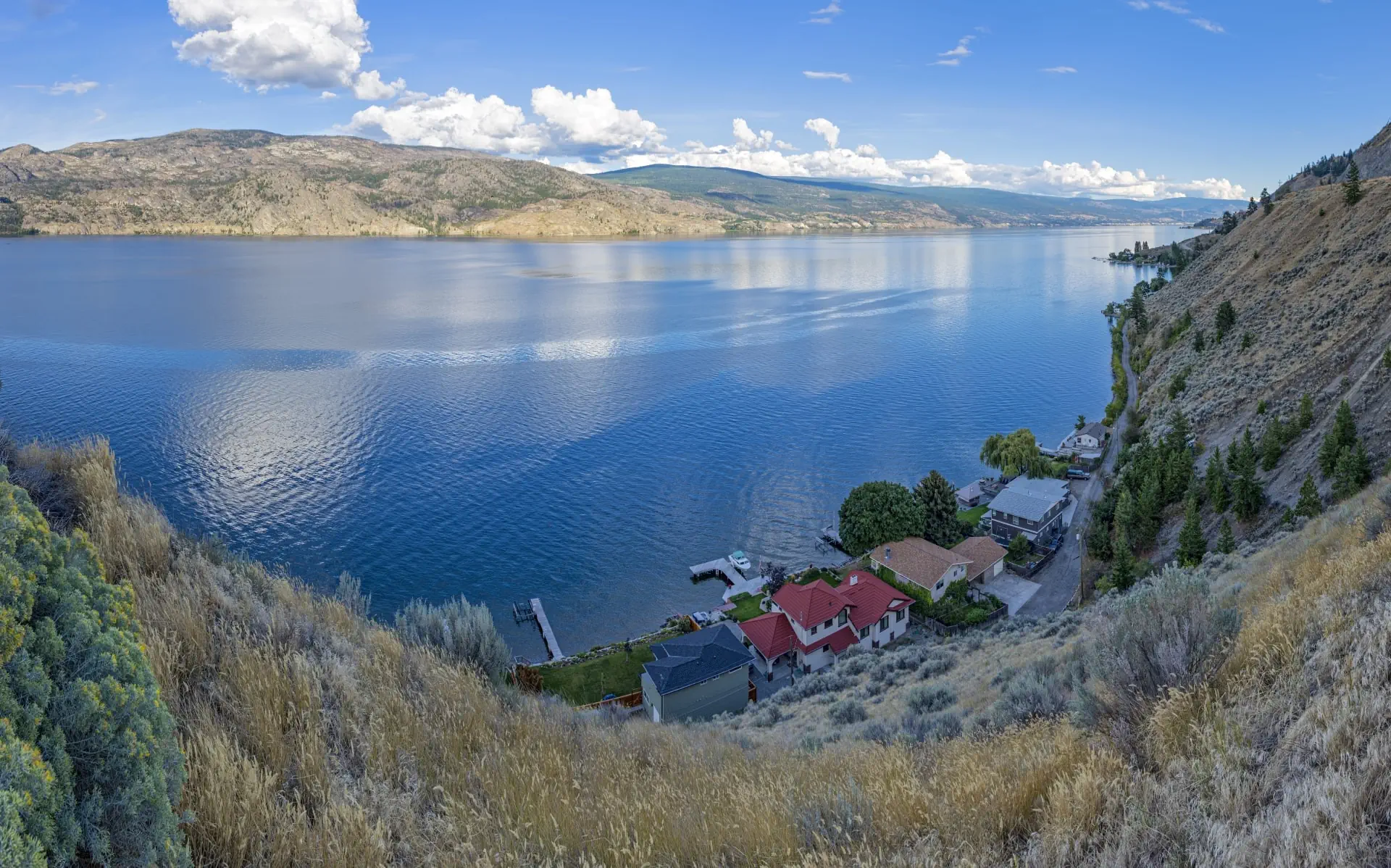
The Lakeshore Zones And Their Benefits To You
- Protect your property from flooding
- Enhance property value
- Improve drinking water
- Protect Species At Risk
Upland, Riparian, Lakeshore, and Aquatic areas are all interconnected and rely on the health of the other zones to sustain a functional ecosystem.
Did You Know?
Any land disturbance in or around Okanagan Lake is subject to permit(s) and approvals. This may include authorizations from multiple agencies prior to proceeding with any proposed development.
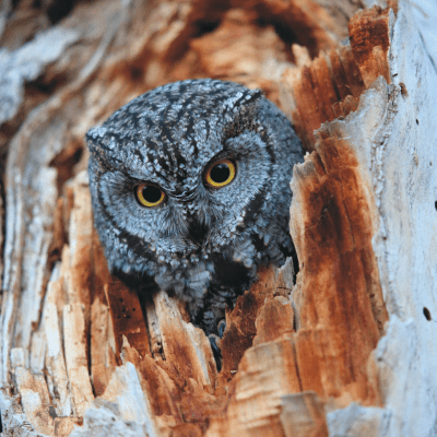
Did You Know?
Western screech owls need older trees in riparian areas to nest, such as aspen and cottonwood. Removing old growth trees or snags in riparian areas alters this critical habitat.
Land below the present natural boundary of the lake is Crown land and is usually represented by the High Water Mark [PDF].
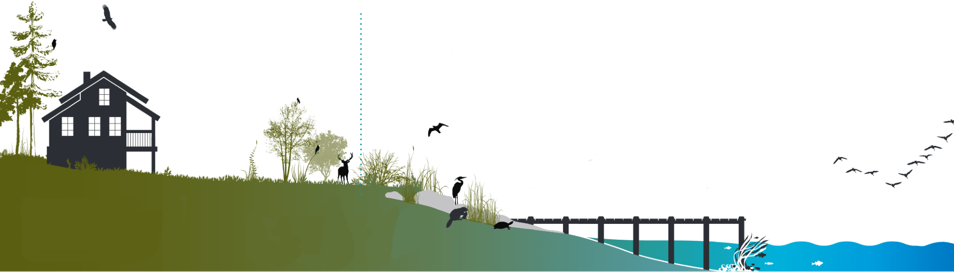
Uplandlocal government
Upland areas are the drier, terrestrial areas above the riparian buffer zone.
How healthy upland areas benefit you:
- Trees and shrubs reduce erosion, improve air and water quality, and help bring soil moisture to the surface for smaller plants.
- Trees help homeowners save money on energy costs by providing shade in the hot summer months, and protecting against cold wind in winter.
Studies show that naturally vegetated lakeshore properties can increase property value.✱
- Native plants are already adapted to the hot Okanagan climate, and require less water.
Beneficial Practices
- Minimize disturbance by leaving as much natural vegetation as possible.
- Avoid trimming vegetation along shoreline properties. If you want to reduce fuels near your home, consider alternate practices like cutting lower limbs.
- Avoid using chemicals for landscaping (fertilizers, pesticides, and herbicides).
- Fertilize your upland garden beds sparingly, and use natural fertilizers like compost or worm castings.
- Use targeted applications of natural pesticides like soapy water, and herbicides like vinegar instead of blanket spraying more toxic products.
- Avoid landscaping using treated wood products.
- Avoid the use of bark mulch near shores, as it produces harmful chemicals that can cause water quality issues, and pollute fish habitat.
- Ensure your septic system is regularly maintained.
Untreated sewage, pollution and waste that enters a waterbody can cause eutrophication (when excessive amounts of minerals and nutrients in a body of water cause excessive growth of plants and algae; a process which may reduce the amount of oxygen in the water). Be conscious of what substances you put down the drain or toilet.
- Avoid putting fats and oils, products containing plastic microbeads, or antibacterial products down the drain and into your septic and sewer systems.
- Avoid washing your car in your driveway. Visit a local carwash, which is required to treat the water before it enters our waterways.
- Consider testing water quality in areas where septic fields have been historically installed adjacent to lakes and creeks.
Riparianlocal government
Riparian areas are the transition between land and water.
How healthy riparian areas benefit you:
- Riparian areas [PDF] improve water quality by filtering runoff and preventing sediments and contaminates from entering the lake.
Some sources of surface water pollution include using pesticides on lawns, oil and gas seepage from driveways, and pet waste. Plants and vegetation in buffer zones [PDF] naturally uptake and filter pollution before it reaches the lake or ends up in our drinking water.
Riparian areas (and upland buffer zones) also provide natural protection from erosion.
- Deep rooted trees and shrubs protect lakeshore areas against wind and wave action. Plants provide 19 to 120 times more protection than large rock (rip-rap).
- Riparian and forested areas act as enormous sponges and can soak up as much as 45cm of rain in an hour. This helps mitigate flood damage.
Beneficial Practices
- Allow native vegetation to grow and establish a natural buffer around the lake.
Riparian Area Regulation is part of the Riparian Areas Protection Act, and requires that the Province of BC is notified and asked for permission before land disturbance within 30 m of the High Water Mark.
- Manage invasive plants.
- Avoid development and turf lawns in riparian zones.
Manicured lawns along lakefront properties do not have the same important features as natural riparian buffer zones. Lawns do not provide the same resistance to flooding and erosion as natural riparian buffers. Water moves more quickly through turf grass towards lakes, streams, and rivers, carrying sediment and pollutants. Lawns do not provide the same habitat value to wild pollinators, and other wildlife as native shrubs, plants, and grasses.
Restoring a natural riparian buffer area contributes to the overall health of the lake, promotes ecosystem connectivity, frames a view from your waterfront property while enhancing privacy, and maintains the natural beauty of the Okanagan Lake shoreline.
Did you know? If you utilize a well as a water source on your property, you are using groundwater. Groundwater is water below the soil surface and is stored in underground rock and soil formations known as aquifers.
When land is cleared or vegetation is removed and replaced with turf grass or pavement, the ground’s ability to absorb and infiltrate water is greatly reduced. This can cause greater spring water flows (freshet) which can cause wells to dry up in summer and fall months as well as deplete aquifers over time.
- Use natural rock and gravel instead of retaining walls and paved surfaces.
- Design a single, unpaved access to the shoreline. Riparian areas offer connectivity to upland habitats for wildlife.
Lakeshoreprovincial government
Lakeshore areas are the sandy shorelines and the lake beds below the present natural boundary.
Natural shoreline processes include the interaction of water, wind, and wave action that give Okanagan Lake its natural shape and various shoreline types.
The best way to protect the shoreline is often to leave it in its most natural state, as plant roots help stabilize the shoreline and protect your property from high water levels.
How healthy lakeshore areas benefit you:
- Aquatic plants form a flexible barrier along the waterfront that dampens the impact from wave action, reducing erosion.
- Undisturbed lakeshores provide safe spawning grounds for salmon and improve lake circulation.
- Natural shorelines provide aesthetic value by framing a more natural view from your home, and offer wildlife viewing opportunities.
Beneficial Practices
- Leave logs and leaves untouched, as these provide food and habitat for fish and wildlife.
- Limit disturbance to the shoreline and lakebed by foot and boat traffic. Never grade, or move soils around the lakeshore.
Okanagan Large Lakes Foreshore Protocol [PDF] provides direction on requirements for provincial natural resource development applications, based on the environmental sensitivity of a site and the risk of the foreshore development activity.
Working Around Wildlife – Best timing windows for development around fish
- Kokanee (Shore-spawning) Jun 1 – Sept 30
- Keep pollutants and chemically treated wood products away from the lakeshore.
Avoid the use of bark mulch near shores as it produces harmful leachates that can cause water quality issues and pollute fish habitat.✱
- Do not add fill, sand, or gravel to the natural shoreline.
Aquaticprovincial & federal governments
Aquatic areas include the water and all living things within it.
How healthy aquatic areas benefit you:
- Water supports life. The lake provides drinking water, water for our crops and supports our recreational activities.
Did you know? Okanagan Lake is a main drinking water source for many of its residents.
-
Water helps regulate climate because it can absorb vast amounts of heat energy.
Asphalt streets and rooves in developed areas get very hot on a summer day, and trap the heat, releasing it at night and creating an urban heat island in cities. Water is able to absorb a large amount of heat energy (a heat sink), so our large lakes help moderate local temperatures.
Water can also dissolve carbon dioxide from the air, and hold it as carbonic acid, which is what we use to give soda pop its bubbles. When carbon dioxide dissolves in water, some of this harmful greenhouse gas is removed from the atmosphere.
- Sunlight penetrates only a short distance in aquatic areas. Clear water in shallow areas promotes the highest diversity of native plants and animals.
Beneficial Practices
- Minimize boat wakes near the shore to avoid erosion and damage to fish habitat.
- Return to shore with everything you brought out with you.
- Invasive zebra and quagga mussels are a huge threat to your investment and enjoyment of your property.
Did you Know? Okanagan Lake is home to several species of native freshwater mussels, such as the endangered Rocky Mountain Ridged.
If you use any type of watercraft (e.g. boat, paddleboard) or water recreation equipment (e.g. fishing gear, water toys), make sure to Clean, Drain, Dry all gear. Learn more at: DontMoveAMussel.ca
THIS IS A GUIDE ONLY AND IS NOT INTENDED TO REPLACE OR SUBSTITUTE GOVERNMENT REGULATIONS OR LEGISLATION.
Riparian Area Planting Guide
Use this guide to choose plants for your upland landscaping, and help expand the riparian buffer around Okanagan Lake in your neighbourhood.
Lakeshore residents can support healthy ecosystems and increase water quality by expanding or enhancing natural buffer zones. Native plants require little additional watering and maintenance after they have been established (usually 2-5 years).
Did You Know?
A natural buffer of 30-50 metres is the minimum width recommended to protect waterways from pollution and sediment. A much wider buffer is needed to protect plants and wildlife from human disturbance.
Recommended Native Plants
Trees
- black cottonwood
- ponderosa pine
- trembling aspen
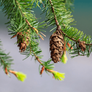
- Douglas fir
- Western redcedar (Thuja plicata)
- Rocky Mountain juniper
- water birch
- paper birch
- black hawthorne
- choke cherry
Other
- Bluebunch wheatgrass
- pinegrass
- junegrass
- fescue (rough, Idaho)
- Sandberg bluegrass
- Columbia needlegrass
- needle-and-thread grass
- Indian ricegrass
- giant wildrye
- sand dropseed
- horsetail, scouring-rush (Equisetum sp.)
- cattail
- hard-stemmed bulrush
Shrubs
- Douglas maple
- red-osier dogwood
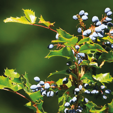
- tall Oregon grape
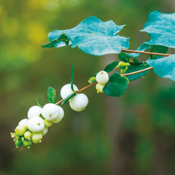
- snowberry
- wild raspberry
- western mountain ash
- willows (Pacific, Bebb’s, sandbar, peachleaf)
- Saskatoon/serviceberry
- mock orange
- blue elderberry
- soapberry/soopolallie/buffaloberry
- wild roses (Nootka, Wood’s, and prickly)
- beaked hazelnut
- thimbleberry
- smooth sumac
- oceanspray
- rabbitbrush
- ceanothus (red-stemmed, snowbrush)
- big sagebrush
- kinnikinnick
- common juniper
Flowers
- showy aster
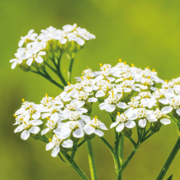
- yarrow
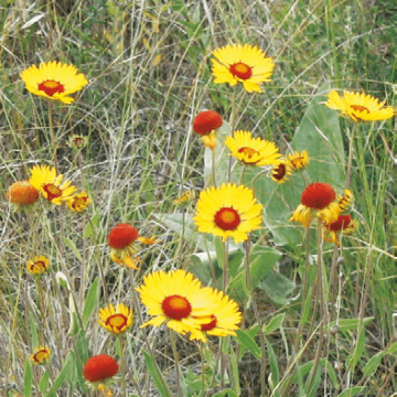
- blanketflower
- heart-leaved arnica
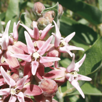
- showy milkweed
- arrow-leaved balsamroot
- showy daisy
- pussytoes (Howell’s, rosy, umber, low)
- shrubby penstemon
- star-flowered false Solomon’s seal
- clematis (white and Western blue)
- hemp dogbane
- common mint
- chocolate lily
- wild sarsaparilla
- desert parsley (fern-leaved, Geyer’s, large-fruited)
- strawberry (wild, wood)
- buckwheat (snow, parsnip-flowered)
- Sitka columbine
- cut-leaved daisy
- golden-aster
- Holboell’s rockcress
- stonecrop
- old man’s whiskers
- prickly-pear cactus
- round-leaved alumroot
- phacelia (silverleaf)
- upland larkspur
- timber milk-vetch
Help Stop the Spread of Invasive Plants
See the Regional District of Central Okanagan Noxious Weed Identification Poster [PDF]
Trees
- Siberian elm
- Russian olive
- tree of heaven
- cedar hedges
White cedar (Thuja occidentalis) is native to eastern Canada and is too water hungry for the Okanagan climate.
Flowers
- purple loosestrife
- yellow-flag iris
- oxeye daisy
- St. John’s Wort
- sulfer cinquefoil
- Dalmatian toadflax
- hound’s tongue
- burdock
- Scotch, Canada, and bull thistle
- knapweed
- Japanese knotweed
- Orange hawkweed
- Non-native wildflower mixes
- baby’s breath
- bachelor’s button
- hoary cress
- mountain bluet
Other
- Cheatgrass
- reed canarygrass
- Eurasian milfoil
With a Few Simple Steps We Can All Protect Our Water

-
Hard Surfaces = Big Consequences
Retaining walls (rock, wood or concrete) increase erosion in adjacent areas. Walls break down over time and are expensive to maintain. Soften your shoreline by replacing hard surfacing with native rocks, gravel and plants to decrease erosion.
-
Filter Instead of Fertilizing
Manicured lawns allow water and pollutants to move quickly into the lake. Fertilizer causes excessive weed and algae growth. Planting and retaining native plants naturally filters storm water and protects water quality from pollution.
-
Protecting the Shore
Clearing rocks on the beach and creating rock piles into the water is known as a ‘groyne’. Groynes force young fish to swim into deeper water where they are in greater risk of being preyed upon. It is prohibited to dump sand, gravel, or fill on the shoreline. Deposits can destroy spawning sites and habitat for fish.
-
Maintain Your Septic System
A properly designed septic system can keep your water safe for drinking and swimming. Need an inspection or maintenance? Contact Interior Health Authority.
-
Use the Power of Plants to Combat Erosion
Frame your view with trees, and retain as many native plants as possible. Deep plant roots are great for holding soil together and stabilizing the shoreline. Trees and plants also provide food and shade for fish.
-
A Dock Dilemma
Docks are easily damaged with high water levels and can cause harm to fish and fish habitat. Construct a pile-supported dock following provincial regulations or consider sharing a dock with your neighbour. Want to learn more? Contact FrontCounter BC.
Consider a shared dock consistent with Provincial and local government regulations and guidelines.
- Information on docks and mooring buoys
- Province’s bulletin on replacing docks
- Guidance for Dock Repairs and Rebuilds Okanagan Large Lakes Post Flood 2017 [PDF]
Approval for docks is regulated by the Ministry of Forests, Lands, and Natural Resource Operations. However, docks must also adhere to specific regulations set out by your local government.
Helpful resources:
Want to Learn More?
Visit the Okanagan Collaborative Conservation Program website for other conservation resources.
 Report All Polluters and Poachers (RAPP) 1.877.952.7277
Or download the BC Wildlife Federation Conservation App on your phone. This tool gives everyone the ability to protect our natural resources for future generations.